Khirbet Sumaqa; Horvat Sumaqa Complete
ID: 110
Region/Province: Palaestina I
Localization
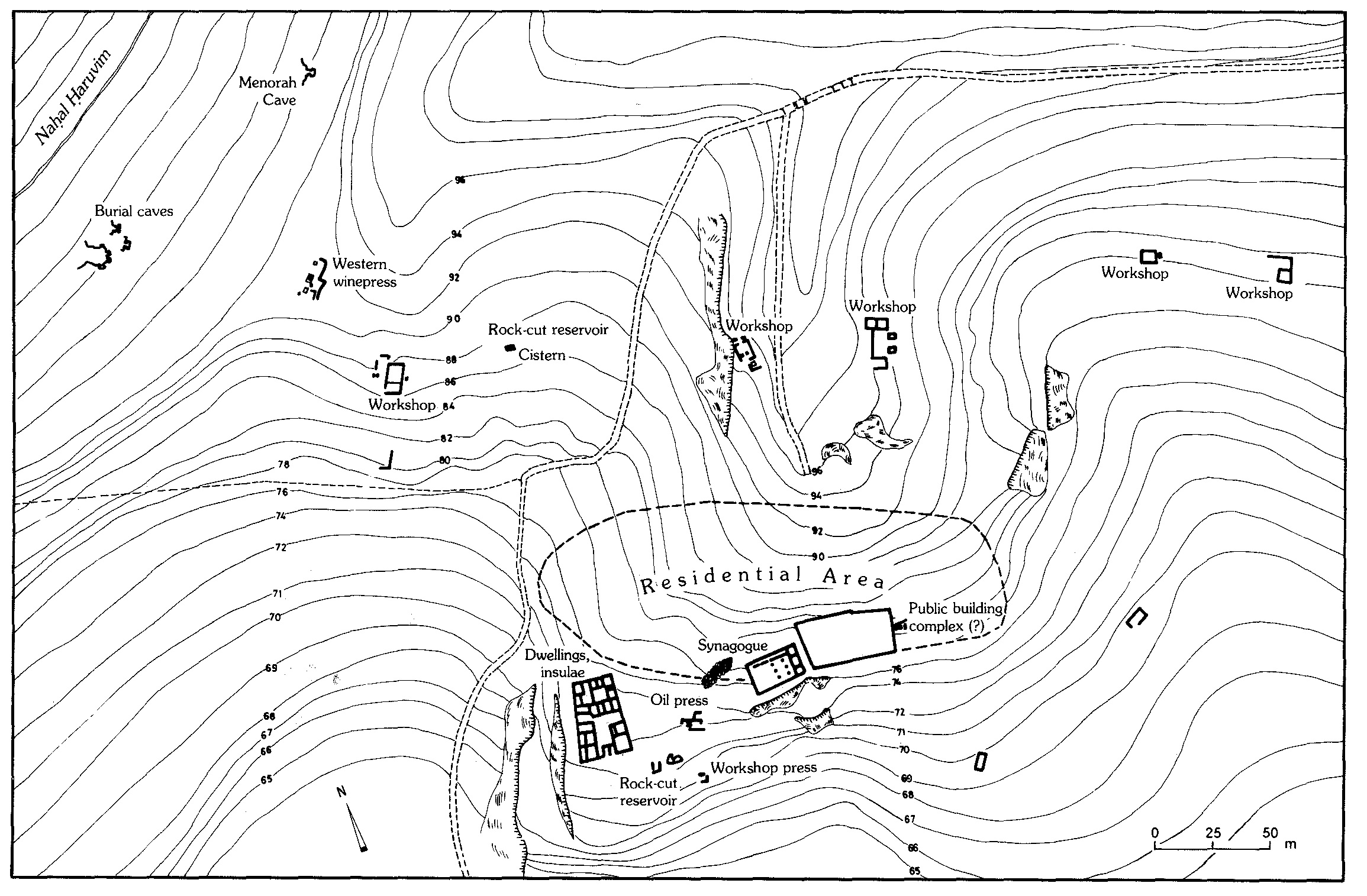
Site plan
Description
Research at Kribet Sumaqa (Horvat Sumaqa) began in the early twentieth century, when H. Kohl and C. Watzinger carried out a small-scale excavation of the synagogue. On the basis of this limited fieldwork, they proposed a reconstruction of the structure’s layout and overall size, relying primarily on comparisons with Galilean synagogues rather than on evidence uncovered in situ. Excavations resumed between 1983 and 1991 under the direction of Shimon Dar on behalf of Bar-Ilan University. The site represents a Jewish village on the Carmel range, approximately 2.5 km south of Daliyyat el-Karmil. Its remains occupy a modest ridge measuring roughly 200 meters in length and lying at an elevation of about 350 meters above sea level. The name Sumaqa reflects an Aramaic term for the shrub known in Hebrew as “og habursaqa'im” (tanner’s sumac), a plant used into modern times as a source for spices and medicinal preparations and in leather processing. Plan source: Dar 1993: 1412. Further reading: Dar, S. 1999. Sumaqa - A Roman and Byzantine Jewish Villge on Mount Carmel; Israel. BAR International Series 815, Oxford, (non vide). Milson, D.W. 2007. Art and Architecture of the Synagogue in Late Antique Palestine. In the Shadow of the Church, Leiden, 402-404.