Horvat Habra; Khirbet Habra; el-Mughar Complete
ID: 100
Region/Province: Palaestina I
Localization
Site plan
Description
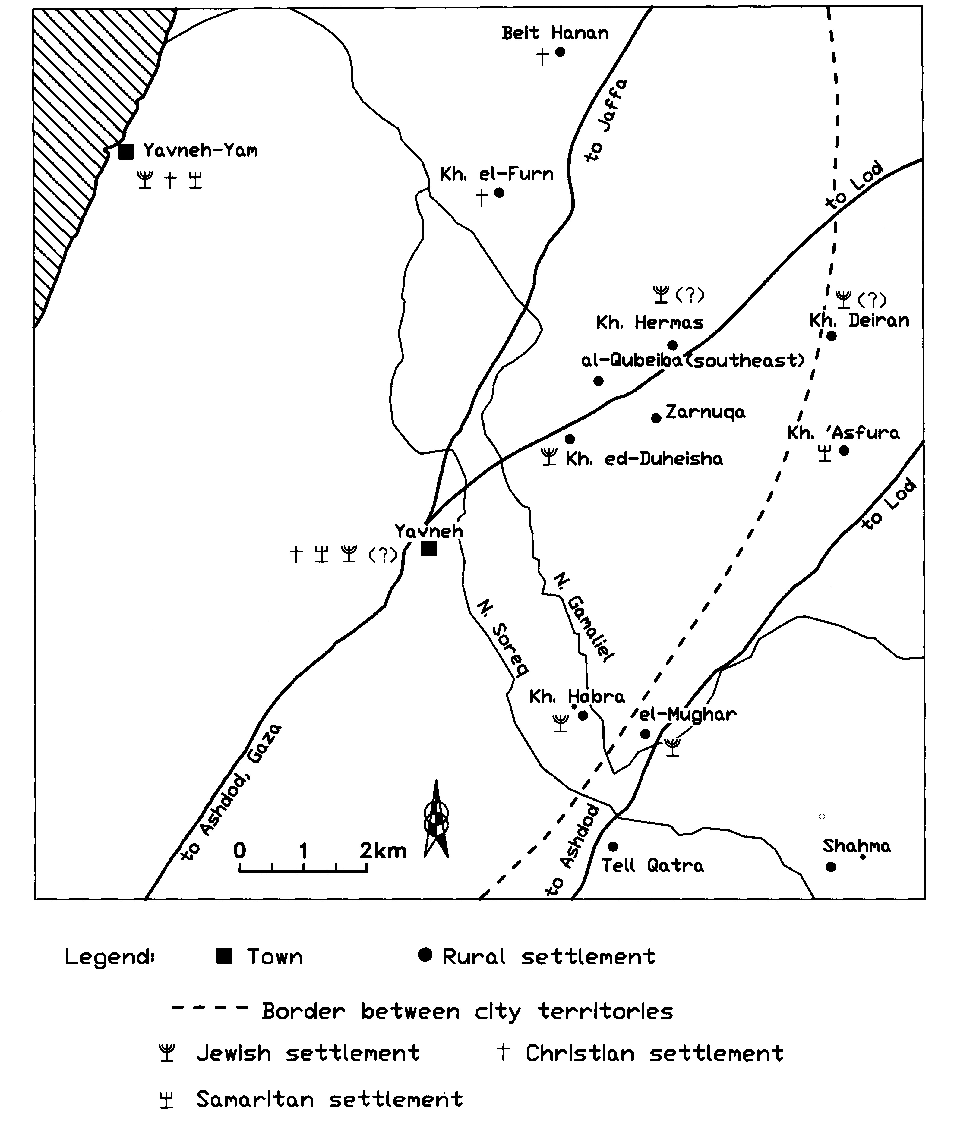
Approximately 3–4 km from Yavneh (Jamnia), within the alluvial lowlands shaped by Nahal Soreq and its tributary Nahal Gamaliel, lie the loci of Horvat Habra and el-Mughar. The precise relationship between them remains uncertain: they may have formed parts of a single village territory, or they may represent distinct settlements. Horvat Habra occupies a modest hill. Numerous artifacts have been recovered there, yet no architectural remains have been documented. The site has suffered substantial disturbance due to intensive agricultural activity, whereas the mound’s eastern sector—planted with eucalyptus—appears comparatively less affected. A synagogue may have stood at Horvat Habra. El-Mughar derives its name from rock-cut caves, which were most likely employed for burial. Map source: Fischer, Taxel, Amit 2008: 9 (fig. 1). Further reading: Fischer, M. , Taxel, I. and Amit, D. 2008. Rural Settlement in the Vicinity of Yavneh in the Byzantine Period: A Religio-Archaeological Perspective, BASOR 350, 7-35. https://synagogues.kinneret.ac.il/synagogues/habra/