Scythopolis; Beth Shean; Beisan Complete
Localization
Site plan
Description
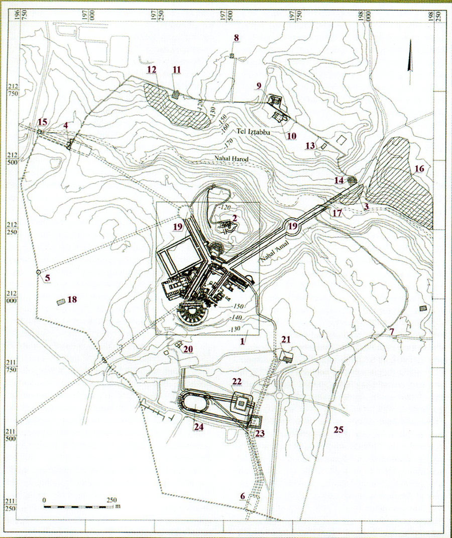
Located at the confluence of the Jordan Valley and the Jazreel Valley, Scythopolis is documented by a site plan that identifies principal features of the ancient city. The plan highlights the following components, grouped by type: - City gates: Northeast (Damascus) city gate; Northwest (Caesarea) city gate; Southwest (Neapolis) city gate; South (Jerusalem) city gate; Southeast (Gerasa) city gate. - Religious institutions: Samaritan synagogue; Church of Andreas; Church of the Martyr; Monastery of Lady Mary; Monastery; Mosque. - Cemeteries: Northern cemetery; Eastern cemetery (Tell el-Hammam). - Bridges: Eastern bridge (Jiser el-Maktu’a); Western bridge. - Civic and public architecture: Civic center; Circular piazza; Bathhouse; Amphitheater (hippodrome). - Domestic structure: House of Kyrios Leontis. - Military and administrative remains: Crusader fortress; Turkish serai. - Urban quarters and mounds: Tell Beth Shean; Hellenistic city; Extra muros quarter (Tell Naharon). Source for the plan and item descriptions: Ousterhout, R. 2013. “Beth Shean revisited: Reexamining a late antique city in transition,” Expedition Magazine 55.1: 10, Penn Museum. Accessed 1 December 2021. See: https://www.penn.museum/sites/expedition/beth-shean-plan/